
Expert Engineering Surveyors in South Australia
Based in Adelaide, John C Bested & Associates is a trusted provider of specialised surveying services for the architectural, engineering, construction and mining sectors across South Australia. With a deep understanding of project demands and an ISO 9001:2015 accredited quality system, we deliver precise and cost-effective solutions for projects of any size.
Whether it's a small levels survey for a residential build or a large-scale topographic survey for road, railway or mine design, John C Bested & Associates brings unmatched expertise and the latest technology to benefit your project.
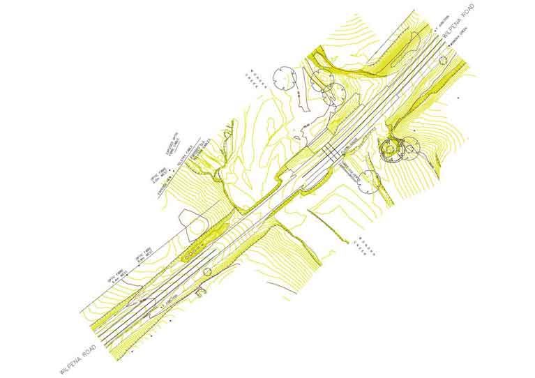
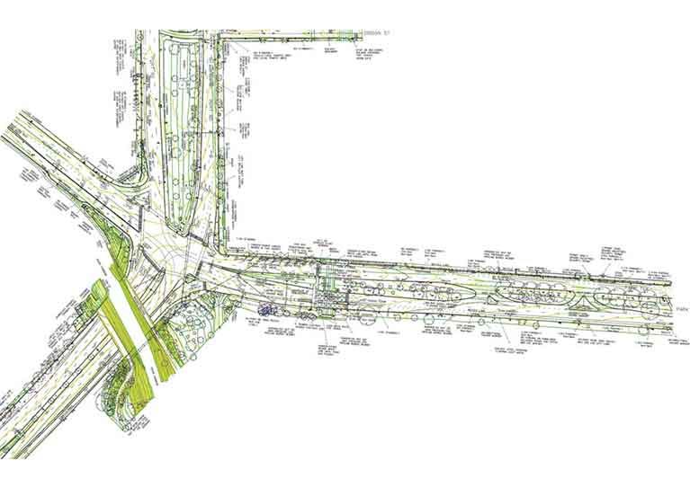
Topographic Surveys
We offer comprehensive topographic surveys to support the planning and engineering critical infrastructure projects such as mines, wind farms, roads, railways, and pipelines. Additionally, we manage the location and survey of underground utilities, ensuring complete and accurate data delivery in the requested format.
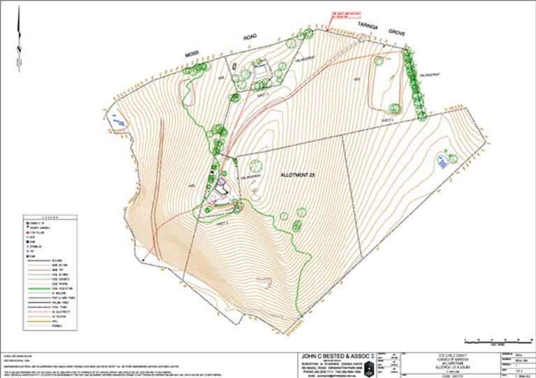
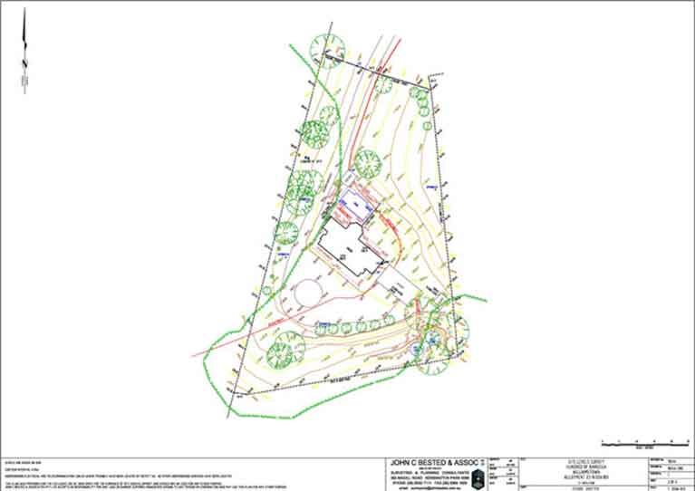
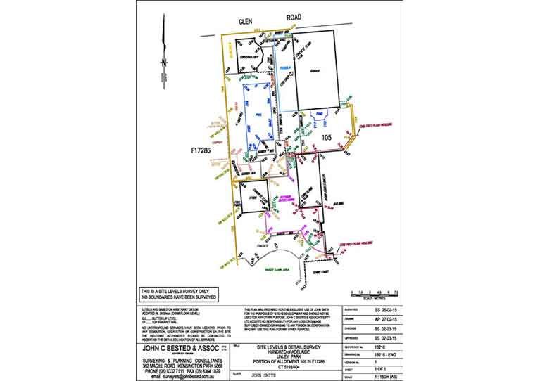
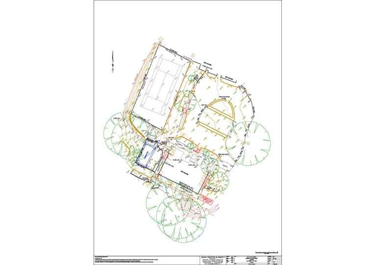
Level & Feature Surveys
If you're embarking on a building or redevelopment project, our level and feature surveys form the foundation for design. These surveys include details such as:
- Existing buildings and structures
- Trees, fences, retaining walls
- Kerb, gutter, and spot levels
- Visible utility services and contours
We provide results in both AutoCAD and PDF formats for easy use by architects, builders, and designers.
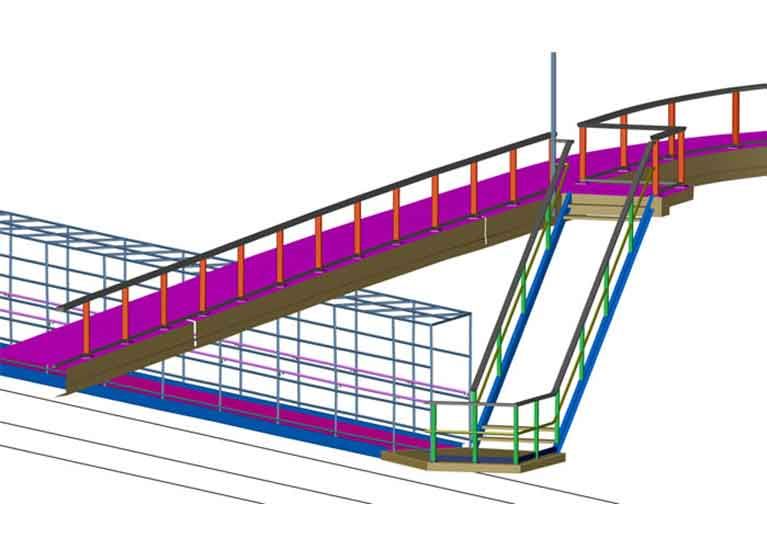
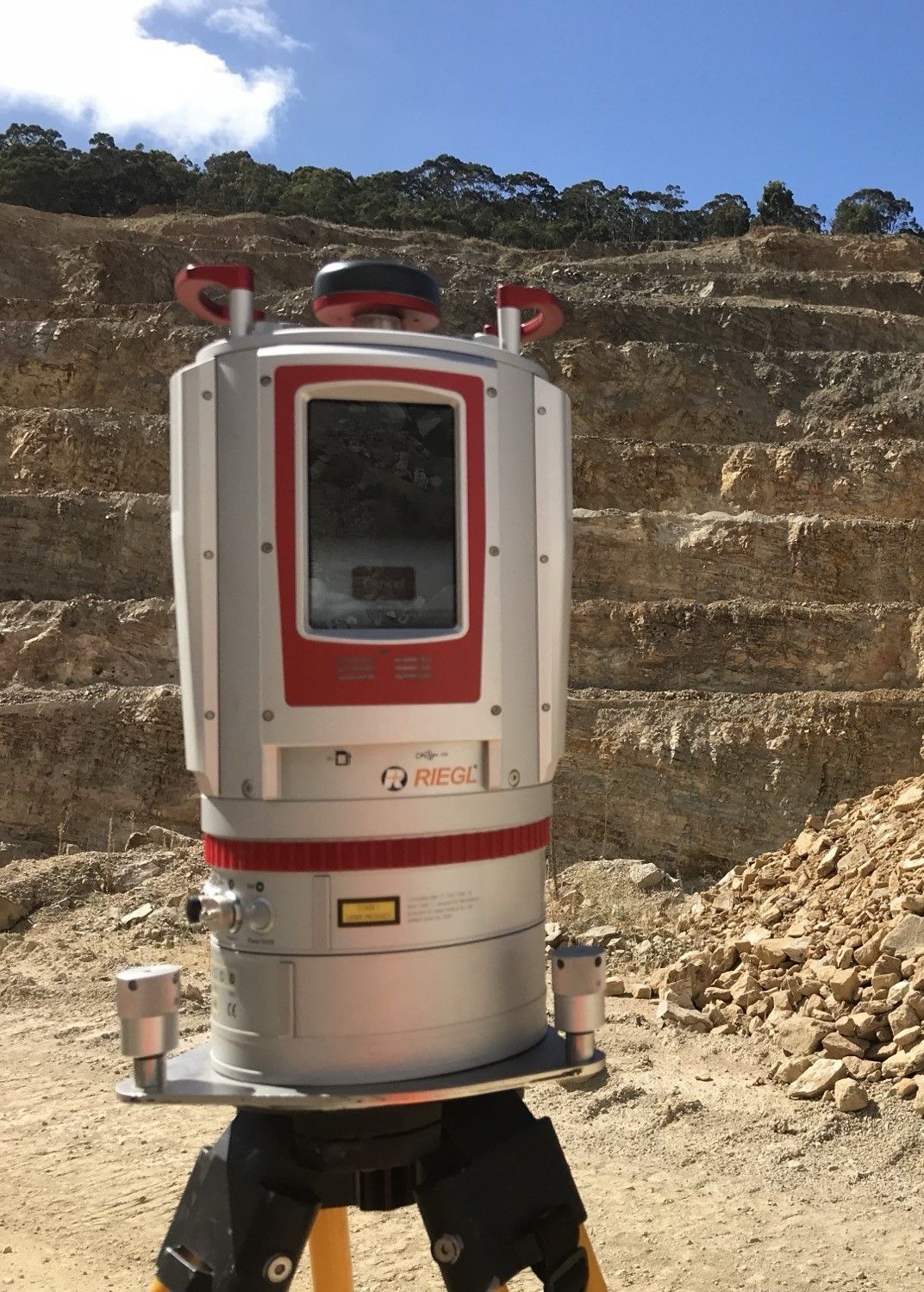
3D Laser Scanning
Our 3D laser scanning technology offers a fast and efficient way to capture complex structures, streetscapes, and landscapes. This method allows us to map:
- Intricate building interiors and exteriors
- Urban environments and road networks
- Large-scale landscapes and infrastructure sites
The result is highly accurate, three-dimensional models for design, construction, and monitoring applications.
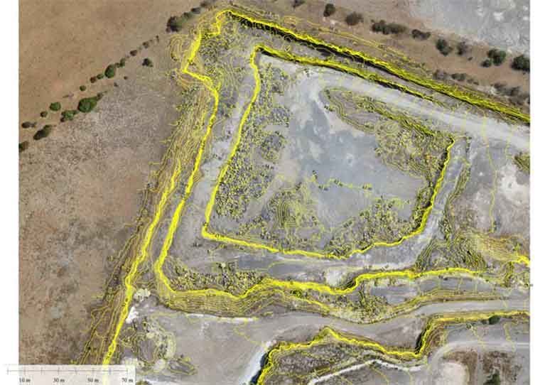
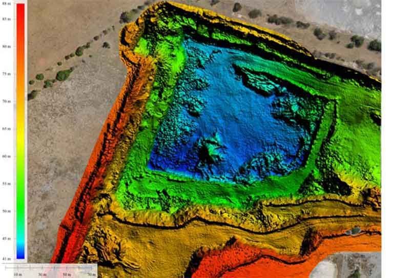
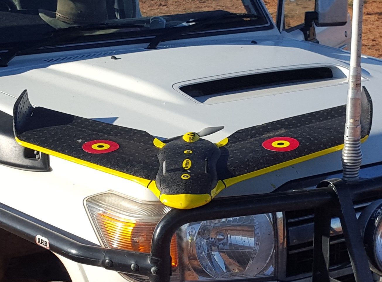
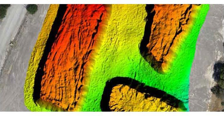
UAV Aerial Mapping
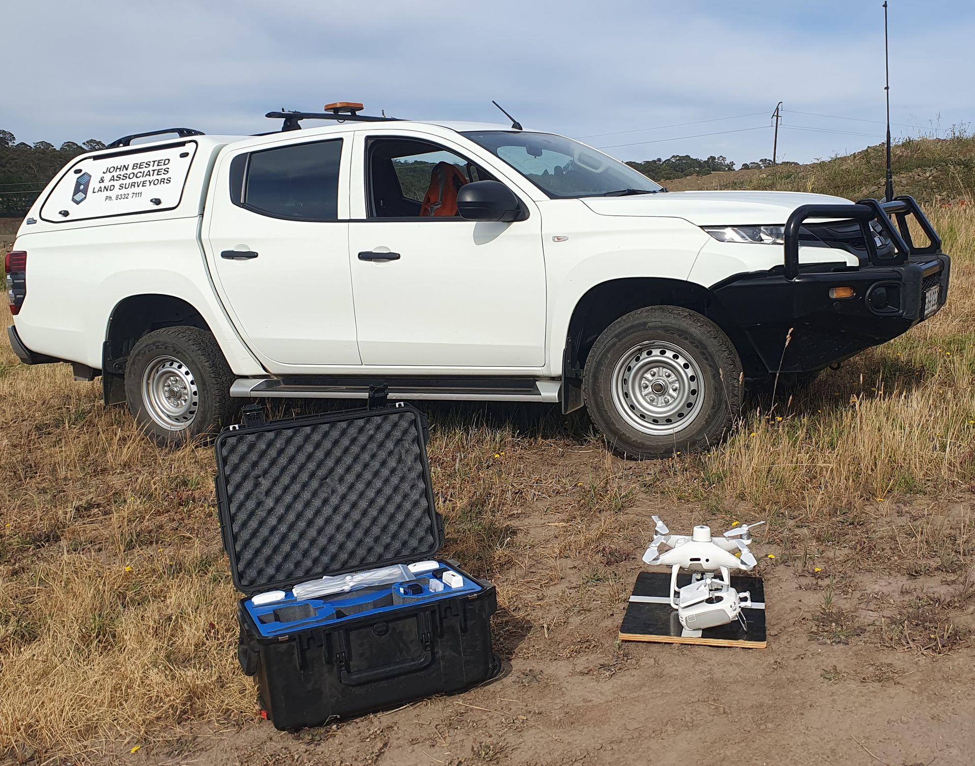
John Bested Surveyors provides affordable aerial mapping services using Unmanned Aerial Vehicles (UAV) across South Australia, delivering spatial data to a wide range of industries and sectors. Our UAV operators are also licensed surveyors, who undertake the project planning, placement and survey of ground control, comprehensive infield measurements for surface verification, image acquisition, processing, surface validation and data extraction.
In many Aerial Mapping projects the integration of traditional surveying techniques is required in order to measure areas obscured by vegetation cover. This would include ground surface levels and any other services or features not captured through dense tree canopies, drainage headwalls, culvert and pipe inverts filled with debris and the location of the underground services where required.
UAV Aerial Mapping combined with traditional surveying methods means we can provide a complete ground / air solution for your next mapping project.
John C Bested & Associates are a Civil Aviation Safety Authority certified UAV Operator.
UAV Operators Certificate Number : CASA.UOC.0259
Applications include:
- Pit Volumes
- Stockpile Volumes
- Environmental Monitoring
- Route Survey
- Topographic Surveys
- Broad acre Subdivision Developments
- Rehabilitation Proposals
- Timeline Surveys
- Landfill Calculations
Deliverables include:
- Geo-referenced Orthophotos (GDA 2020 Datum, Local Datum or Mine Datum)
- Point clouds
- Digital Terrain Models
- Full 3D feature extraction of both String and Point Data in layered models to suit client’s requests.
- Topographic / Engineering surveys
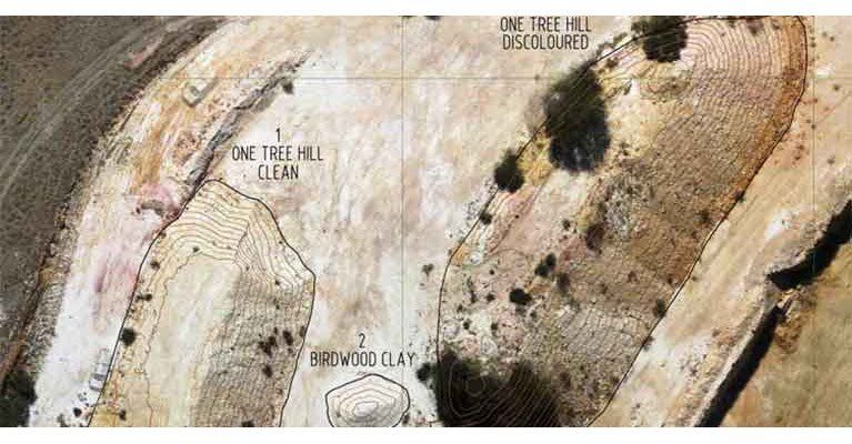
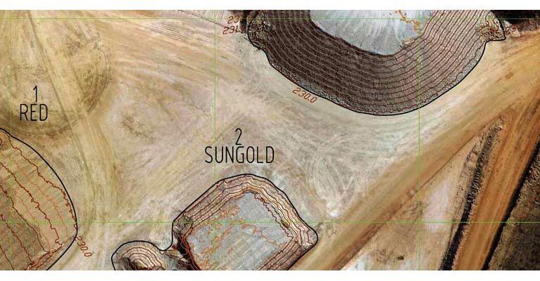
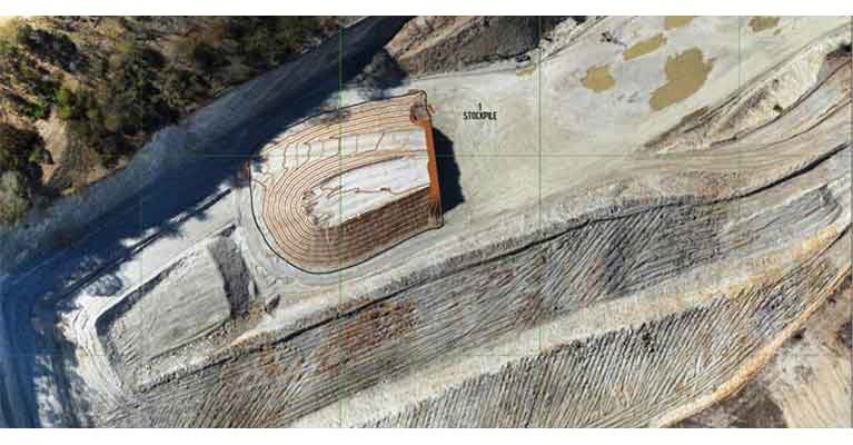
Stockpile Volume Calculations
Using advanced 3D surface modelling and UAV technology, we perform stockpile volume surveys for mines and other industries. Our methods ensure accurate volume calculations for monthly, yearly, or project-specific needs.
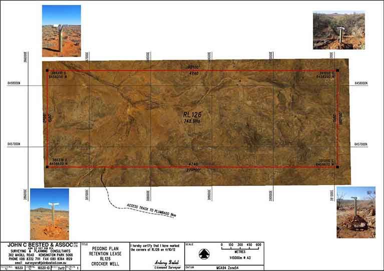
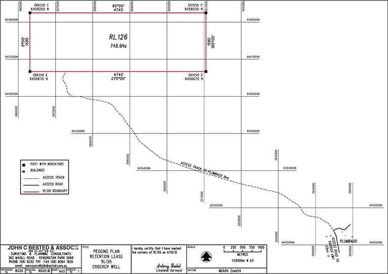
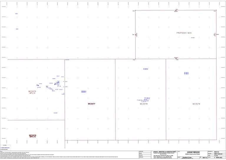
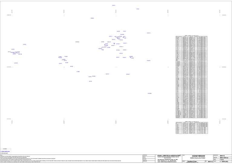
Mining Tenement & Exploration Surveys
John C Bested & Associates supports mining operations with:
- Tenement boundary surveys
- Exploration borehole setouts
- Mine infrastructure and pit layout planning
We can assist with drill hole grids, bore field development, and ongoing infrastructure layout.
Exploration Borehole Setout & Gridding
- Exploration surveys including gridding and Drill Hole setout. Mine Development surveys including Bore field, Mine Infrastructure, Pit layout and Road set out.
We can assist with drill hole grids, bore field development, and ongoing infrastructure layout.
Powerline & Pipeline Route Surveys
Our team offers route surveys for powerline and pipeline projects, providing accurate data to facilitate design, planning, and construction. With our experience in engineering surveys, we help ensure that your infrastructure projects stay on track.
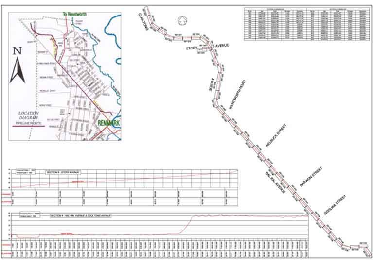
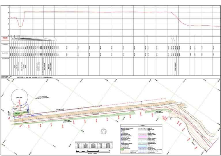
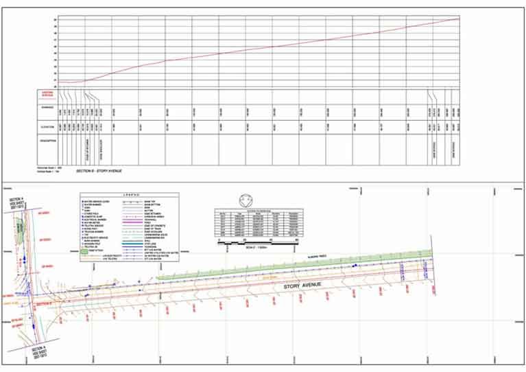
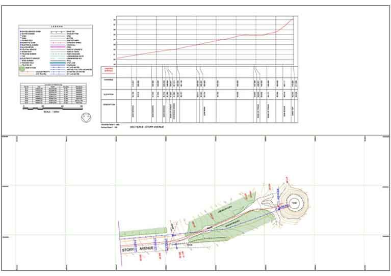
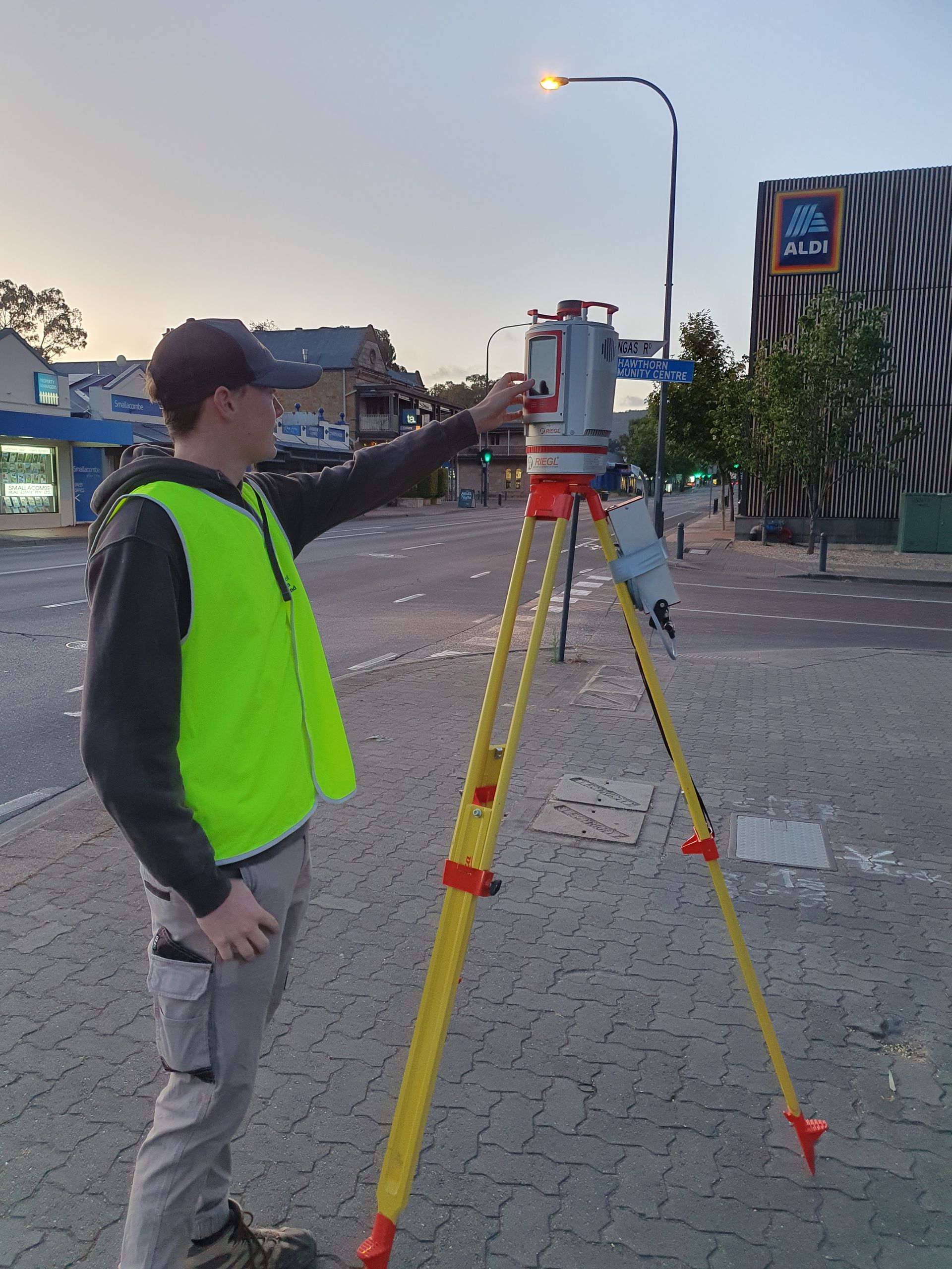
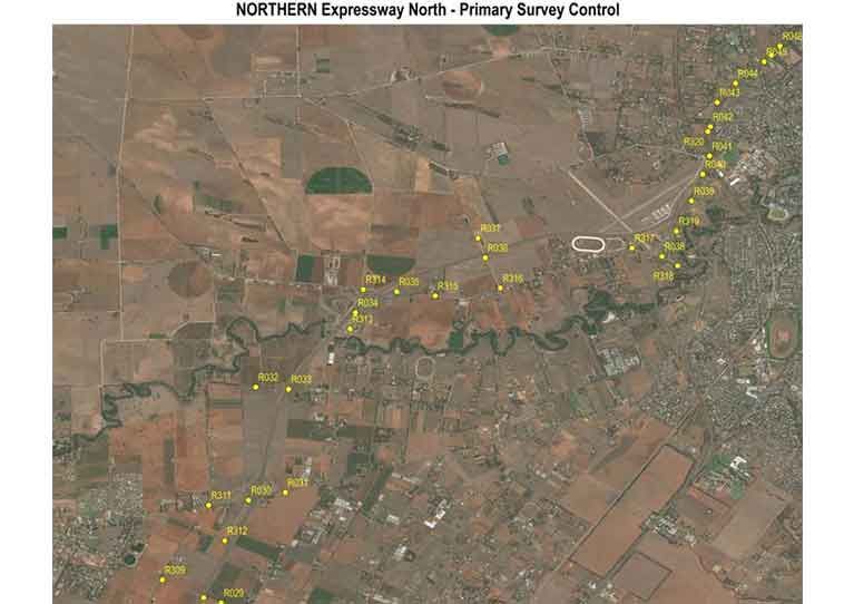
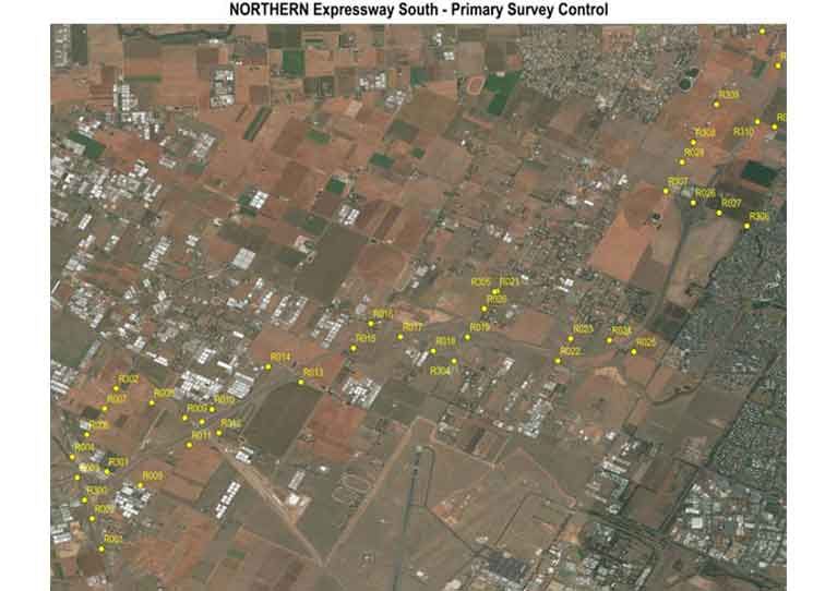
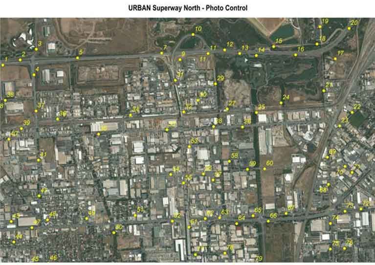
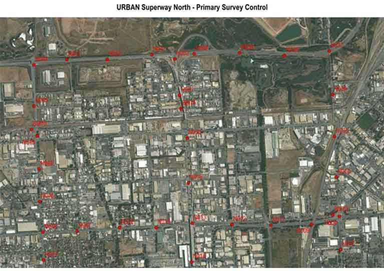
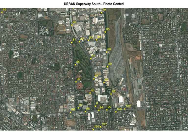
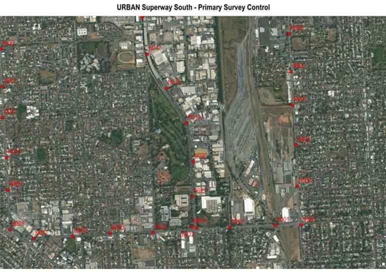
Control Surveys for Infrastructure Projects
Control surveys establish a consistent network of points for large infrastructure projects. Our expertise includes:
- Northern Expressway
- Urban Superway Project
- South Australia Railway Revitalisation
These surveys ensure consistent accuracy for all phases of development. We also perform photogrammetric control surveys, enabling precise aerial image processing.
Partner with John C Bested & Associates for trusted engineering surveys across Adelaide and South Australia. Our team is ready to deliver high-quality results for your next project—whether it's a road network, a mining operation, or an environmental survey. Contact us today to discuss your surveying needs.
Get accurate engineering surveys from John C Bested & Associates. Call us today on 08 8332 7111 to discuss your project.